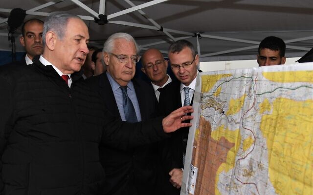
Members of the US-Israeli mapping committee tasked with drawing up the borders of the Trump peace plan have been seen out in the field just once since Washington unveiled its proposal nearly six months ago.
That expedition, to the northern West Bank’s Ariel settlement, took place in late February, weeks after the plan’s architect Jared Kushner said the joint team would be “going line by line and street by street to decide where to put the borders.”
Over three months have passed since, during which the coronavirus pandemic has somewhat understandably kept the map-drawers from crossing the Green Line to pick up where they left off.
Both Israeli and American officials have recognized, at least behind closed doors, that the mapping committee will therefore be unlikely to complete its work by July 1, the date on which Prime Minister Benjamin Netanyahu has vowed to move forward with annexation.
But with neither side willing to comment publicly on their progress, Israelis and Palestinians have been left in the dark on the crucial decisions being made that could determine the future borders of their states.

Prime Minister Benjamin Netanyahu, left, US Ambassador to Israel David Friedman, center, and then-Tourism Minister Yariv Levin during a meeting to discuss mapping extension of Israeli sovereignty to areas of the West Bank, held in the Ariel settlement, February 24, 2020. (David Azagury/US Embassy Jerusalem)
In an effort to better understand the challenges the cartography committee is tasked with addressing, The Times of Israel spoke with several former Israeli officials who filled lead roles in similar mapping projects.
They explained that given the complex nature of the job and the inability of members to make trips to the West Bank, the delay is to be expected. They also sketched out the key questions that the current mapping team will have to answer in order to return to Netanyahu with the final borders for his unilateral annexation plan. READ MORE